
About Us
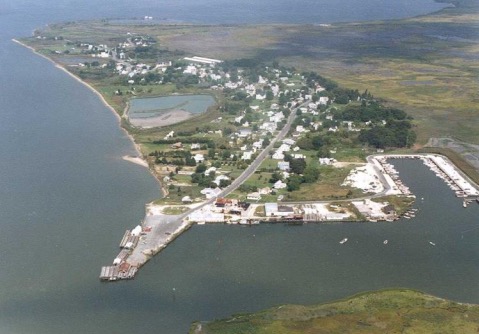
Aerial View - Courtesy of Saxis Island Museum
Welcome to the Town of Saxis! Saxis encompasses an area of 0.42 square miles, many refer to the town as an island, however it is not entirely surrounded by water, it is actually a peninsula. The name Saxis Island was appropriate due to it's isolation when cars were not the means of transportation.
The earliest document related to Saxis was on a map published by Capt. John Smith in 1608. In 1666, the land of Saxis Island was patented by European settlers. Saxis today is still a small fishing and crabbing village along the Pocomoke Sound, located in the Chesapeake Bay. The town is known for its abundant crabbing, fishing, oystering and clamming harvest. The tidal marshland is part of the Saxis Wildlife Management Area; it is approx. 5,678 acres of untouched area for wildlife and bird watching This area is a great place to experience nature at its best.
The town harbor provides boat slip accommodations, restroom facilities, and a pavilion that can be booked for private parties, picnics, or just an area to enjoy lunch with a pictureque view of the harbor.
We strive to make Saxis a great place to visit for a day trip or weekend getaway, but it is also a GREAT place to call HOME.
To access this document please click here...